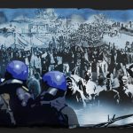
Hidden Hout Bay
With his intimate portraits of the marginalised in Hout Bay, photographer Sid Luckett reveals the lie behind the sometimes sanitised history of the Cape.
Author:
1 February 2019

Hout Bay, a suburb of Cape Town, is demographically more typical of small towns and coastal rural villages of South Africa than other suburbs of Cape Town. Unlike most suburbs, it has the three major racialised groups of South Africa living side by side. They remain visibly divided – with a slight blurring of the edges – along the contours of the apartheid Group Areas Act geographic separation: a central lush suburban valley and surrounding mountainside which, during the apartheid period, was allocated for whites only is flanked by two ghettos, Hangberg for coloureds and Imizamo Yethu for black Africans.
The strikingly beautiful bay, marked in early 16th century Portuguese maps as Porto Fragoso (fragile or jagged port), opens into the Atlantic Ocean. It is bordered on either side by the Table Mountain range, which at one end closes into a narrow neck with a road leading to the wealthy mountainside suburb of Constantia, and, on the other, opening out onto the half-moon shaped bay, with a scenic road between mountain and sea. It has become a major global tourist attraction because of its natural beauty.
Related article:
Pandering to the tourist market is Schire’s photo-rich history of Hout Bay, Embracing Hout Bay, available at Mariner’s Wharf, a restaurant on the harbour, and at other popular tourist locations. Unsurprisingly, this “history” tells the story of three generations of the Dorman family and the enterprises they established in this once small fishing village. But the history of human settlement in the bay goes further back than the village. There is evidence that migrating Khoen-Khoen (Khoi) family groups had settled, or at least passed through, Hout Bay before Jan van Riebeeck visited and gave the wooded valley its name.
In the account of another of these Dorman enterprises, Chapman’s Peak Fisheries, the local coloured fishermen and women who feature in the story play only a secondary supportive role. We are told, for example, of Freddie Knowles, “who had joined Chapman’s Peak Fisheries way back in 1958 at the tender age of 16. Like many of the local lads, Freddie came from a fishing family and had regularly gone to sea with his father during his childhood. At first, Freddie worked for Harold Dorman whom he fondly remembers as a fair and kind man”.
This extract typifies what scholar Achille Mbembe refers to as the “inextricable network of meaning” connected to the colonial gaze. The story of Hout Bay could be told very differently. Mariners on the spice trade routes to the Far East established a colonial settlement in Table Bay, reaching across to Hout Bay and beyond. The settlers expelled the indigenous people of the Cape, from whom the majority of the harbour community are descended, and who, until then, had roamed freely on land and sea, enjoying a way of life that sustained them materially and spiritually.
Before the advent of the Group Areas Act, Hangberg was little more than a workers’ hostel for those who worked in the fishing and lumber industries of Hout Bay and were categorised as “bantu”. With the introduction of the act, Hangberg was designated a coloured area and all coloureds living in the valley and working as sharecroppers, farm and household labourers were forcibly removed – sometimes on two or more occasions – into council houses and flats.
Related article:
At the same time, Imizamo Yethu, a name residents later gave the area, was declared a “bantu temporary camp” to accommodate the workers who had been removed from the “bantu hostel” in Hangberg. Although this designation legally fell away with the advent of South Africa’s pseudo-democracy – the power of the citizens vote has been usurped by a market economy – in 1994, it remains a material reality.
The photos in this collection offer a glimpse of Hout Bay beyond what tourists and Cape Town’s wealthy, mainly white residents see. They depict the lived reality of the Hout Bay Harbour Community, the name given to Hangberg by the coloured people of Hout Bay whose lives belie the myth of neoliberal development held onto by Schire’s book and embraced by successive South African governments.
The photographs begin with the “veil” over Hout Bay, which hides the “unsightly” ghetto home to the Harbour Community. The photos then penetrate the myth of development to uncover the lives of individuals who were forcibly removed from the fertile middle valley by the apartheid regime.
A quarter of a century after South Africa’s first democratic elections and the same people remain marginalised, unable to access the sea or land legally. Now, the big fishing corporations enclose the sea common, having been granted the bulk of the total allowable catch for commercial purposes, leaving the subsistence fishermen and women unable to sustain livelihoods.
The images in this piece were taken between 2015 and 2018.


